Combining Technology and Building Information Modeling

The future of farming is using drones and sensors
January 3, 2022
A new Bayraktar VTOL drone was introduced
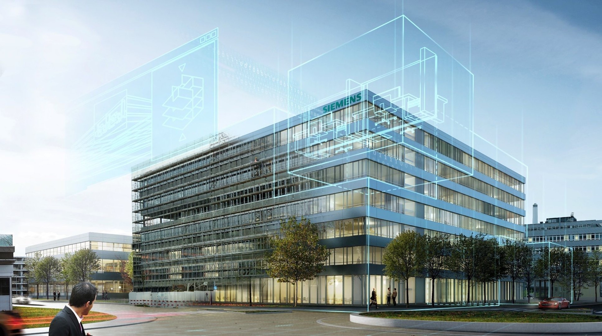
January 5, 2022With the advent of ever-improving drone technology and Building Information Modeling (BIM) software, constructing a building has never been more efficient and accurate. By using drones and laser scanners to capture real-world environments, architects are provided extremely detailed interior and exterior views of a project site, helping us make important design decisions in response to the environment. The combination of laser scans and BIM software allows us to analyze the data captured to make better decisions and to help implement building designs that meet client goals.
What Specific Roles Do Drone Technology and BIM Construction Software Play in a Building Project?
Drone technology and BIM construction technology are often conflated because they are typically used together in complex building projects. However, these two technologies perform quite different functions.
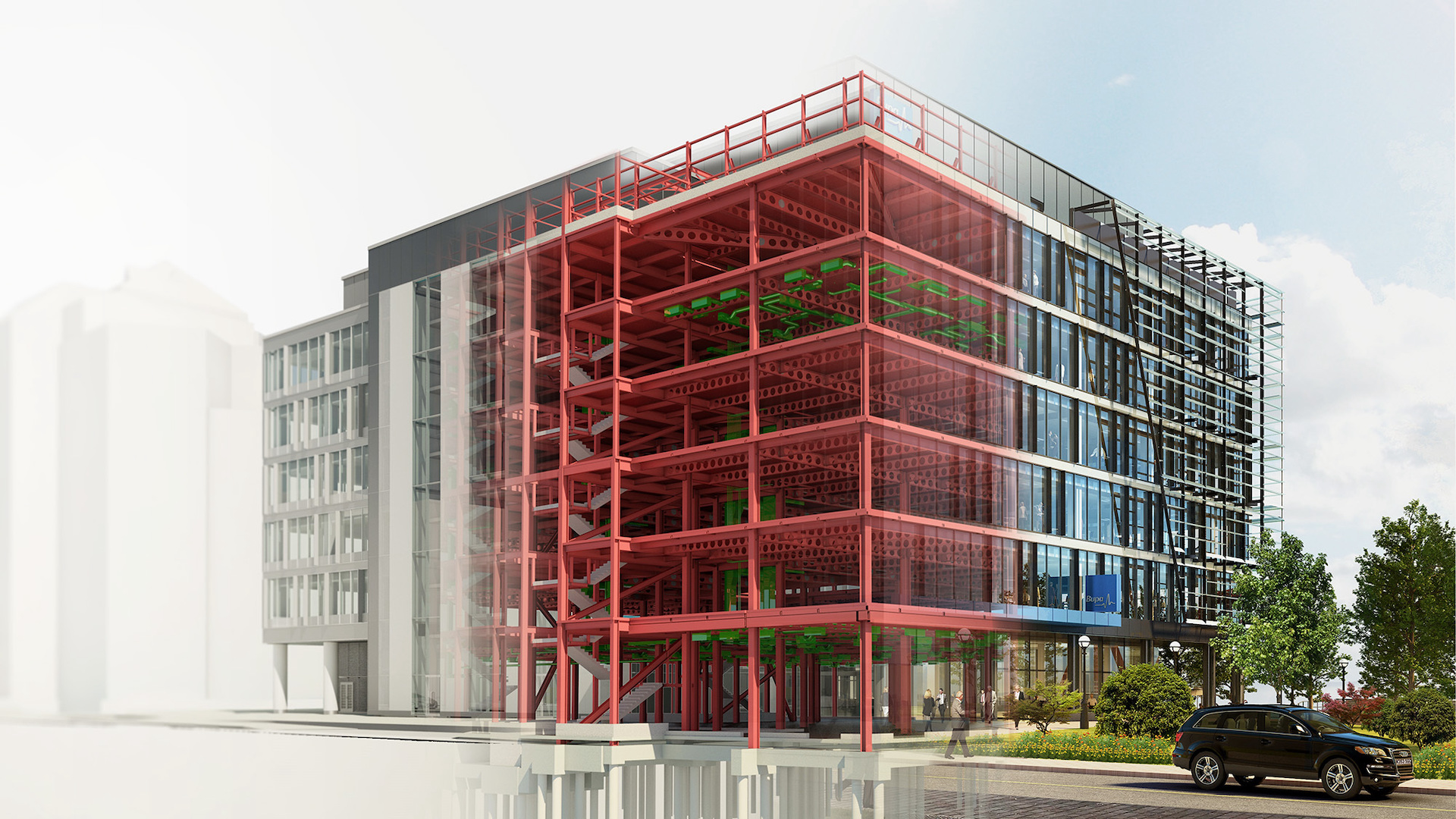
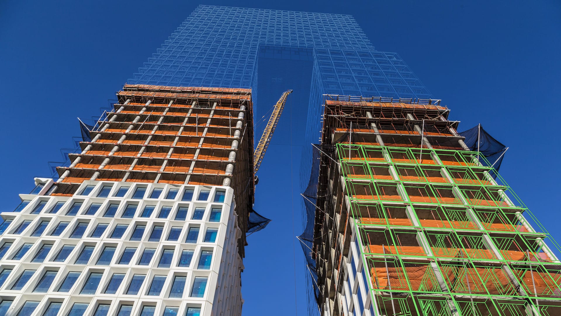
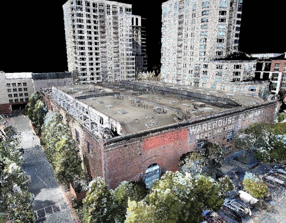
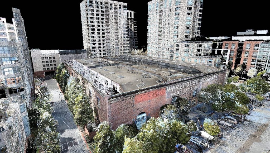
Drone technology is primarily used to take and analyze detailed photographs, videos, and laser scans of a construction site—a process called reality capture. Through this process, architects and building planners can ensure that a building fits into the contextual environment, identify potential construction challenges, and track project progress. BIM construction software, on the other hand, creates accurate 3D models of buildings from reality-capture data so that architects can plan a project from start to finish. The features and tools of BIM software vary from brand to brand, but most include the ability for project teams to collaborate in the cloud, create construction documents, and integrate with Virtual Reality (VR).
After drone images and scans from a building site are analyzed, BIM construction technology provides the project team with an even better understanding of the project’s scope and context. Drones essentially play the role of data suppliers for the BIM construction software, feeding the software information about existing site conditions to ensure that the digital 3D model created through the BIM software is as accurate as possible.
By using these two technologies together to ensure a perfect match, you’ll streamline your entire design process and visualize exactly what your building will look like when it’s complete.
How to Use Drones and BIM Construction Software to Visualize Projects
To harness all of the power and reap all of the benefits of drone technology and BIM construction software, you’ll need to take advantage of the powerful tools and features of both.
There are two types of drone reality capture:
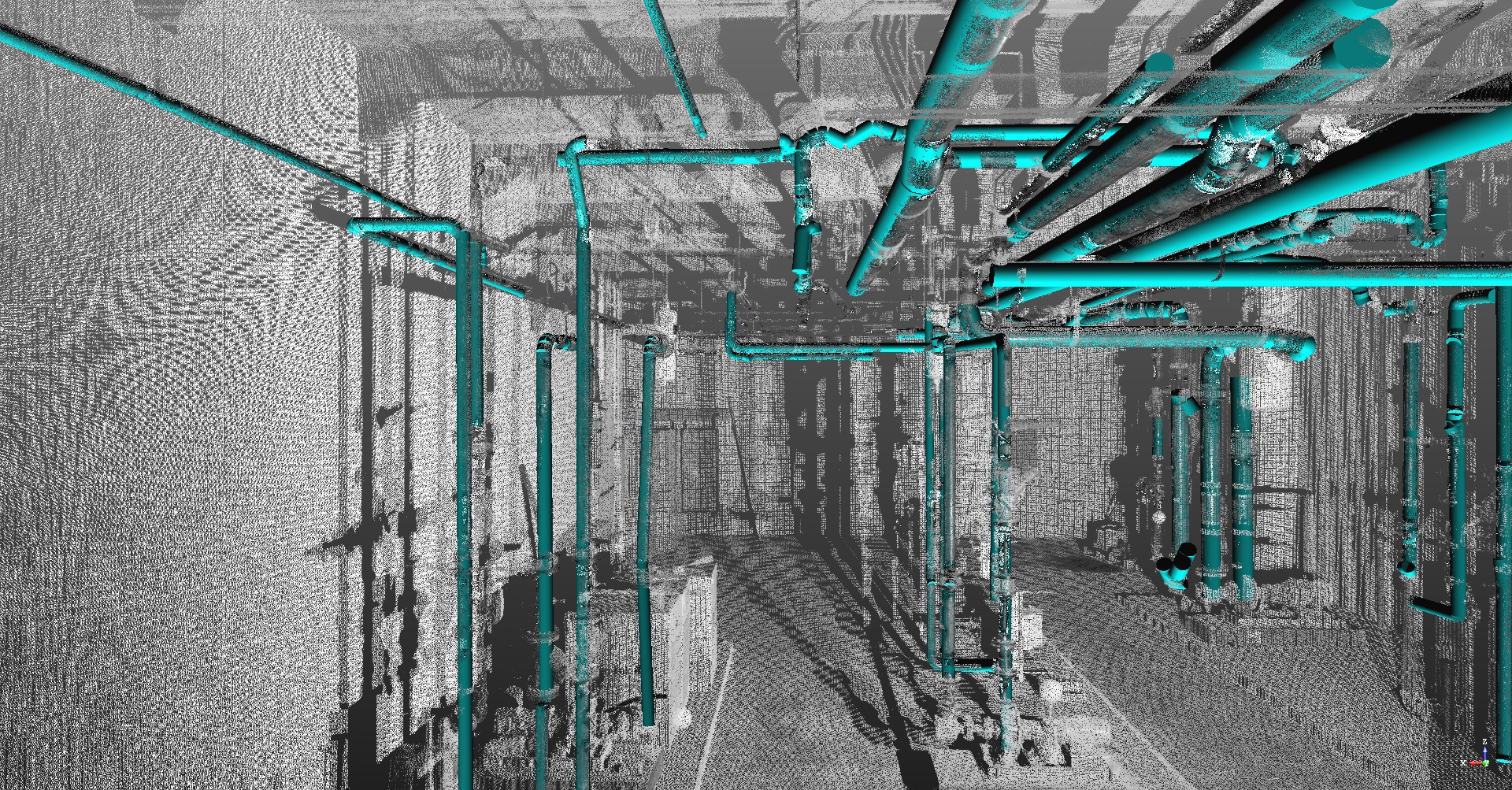
- Interior reality capture. Ground-based scanners and drones take extremely detailed photographs and laser measurements of a building’s interior. This process can take place during any phase of a project. They are moved around in standard increments, and some of the newest models even roll around the job site on their own. They are best suited for nearly-completed projects where floors are fairly level and smooth. Airborne drones are typically used when the ground is rugged and during the early stages of construction before walls have been built.
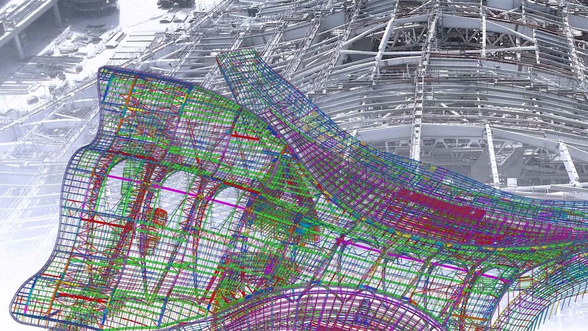
- Exterior reality capture. Drones take photographs of the entire construction site from the air. The results are slightly less detailed than those of interior-reality capture because they work typically with photography instead of laser measurements. Once the photos are gathered by flying in intricate patterns over a project, they are stitched together using a method called photogrammetry to create 3D models. Extraneous objects, such as trees and power lines, get captured as well, which can either be stripped away or used as reference material during the design process. Still, important project information can be gathered. For example, by doing a cut/fill analysis of the site, architects and engineers might discover that less earth needs to be moved on large projects, ultimately saving enormously on costs.
When the power of drone technology is combined with Building Information Modeling (BIM) construction, software, architects and building planners have even greater over every aspects of their construction projects
Once drone photos, videos, and laser measurements have been taken, the images, point clouds, and models are imported into the BIM construction software, which allows architects and planners to do the following:
- Make informed design decisions. The 3D models that result from reality capture allow architects to see potential problems or opportunities in the digital environments right away. For example, a space could be reconfigured based upon necessary sight lines, or windows could be moved to capture important views.
- Check the accuracy of building element placement during construction. A point cloud is made up of millions of 3D location points which allow architects to quickly find true dimensions of spaces, walls, windows, etc. These scans can be accurate within 1 mm. As a project progresses, multiple drone readings are taken of a site and then compared to earlier results to make sure progress is going as planned.
- Integrate BIM with VR. When a BIM 3D model of a project is placed into VR technology, designers can “walk” through the building at full scale to better visualize and experience it. For example, they can look for clashing objects, further optimize wall and ceiling cavities for ducts and piping, and adjust the building layout to improve employee and visitor wayfinding—all before the building is built.
- Improve safety on the site. Drone technology is used by architects, contractors, and OSHA to ensure worker safety and to confirm easy access to safety equipment. BIM construction software plays a safety role, too, keeping track of emergency equipment locations. Proper safety protocols must be followed during the construction phase of a project, and these technologies help ensure the rules are being followed.