Reality Capture Technologies for Construction

The future of farming is using drones and sensors
January 3, 2022What Is Reality Capture?
Reality capture refers to the process of scanning an object, building, or site in the real world and converting the scan data into models and visualizations that are useful for design and construction workflows. Specifically, today’s reality capture technology can quickly and cost-effectively create textured, high-resolution, geometrically precise 3D models that can be manipulated in design and construction software, replacing many of the traditional methods of surveying and assessing a construction or renovation site.
Why Reality Capture Matters
In the U.S., 80% of non-residential buildings are more than 20 years old, while many portions of the nation’s infrastructure, though designed for a 50-year lifespan, are currently over 50 years old. This means that there is a large and growing need for renovation of these assets. Additionally, new construction continues to heat up while demand for faster, better, cheaper, and higher quality buildings increases.
Old methods of converting existing site and structure information into usable “as-built” models for planning renovations, demolition, and/or building/rebuilding are costly, time-consuming, and limited in their accuracy. Modern reality capture, however, changes the as-built game.
Previously, it required expensive equipment operated by highly trained technical staff to get accurate reality capture data. Now, it can be completed in a fraction of the time with only basic training and certification, using equipment that is readily accessible and affordable for any size project.
The 4 Reality Capture Technologies You Need to Understand
Many construction companies have begun implementing reality capture technologies at the project level. Even small companies may now own a drone to capture photos and video to share with owners and stakeholders and subs. To get the most benefit from reality capture, however, leading companies are integrating 4 key technologies into their system to ensure they begin with fast, accurate, cost-effective, and useful data.
#1: Unmanned Aerial Vehicles (UAVs aka Drones)
Many of today’s job sites would look like a science fiction set to construction workers of even 20 years ago, partly due to the frequent presence of small flying “robots” (aka unmanned aerial vehicles). Now, drones in construction have become so common on job sites that most people hardly take a second look.
There are 3 reasons for this sudden explosion:
- Drones have become inexpensive to own and operate
- The FTA created clear and practical rules for legal commercial use
- They make it fast, easy, and cheap to gather critical site and structure data
A drone equipped with the right scanning equipment becomes a powerful reality capture tool. Instead of hiring a plane to take aerial views or ground crews to execute exhaustive surveying, a drone can be deployed in a matter of minutes and the data made available within hours rather than days or weeks or even months.
#2: Photogrammetry
Photogrammetry is a form of 3D scanning that uses photographs and triangulation to create an accurate model of a site or structure. Photogrammetry scanning can be performed at close range, via satellite, or from the air.
For construction projects, drones have transformed photogrammetry from an expensive and time-consuming option to a simple and inexpensive one. Mounted on a drone, inexpensive photogrammetry equipment can quickly take photos of an entire site and structure from multiple angles, and triangulate the visual data to create a 3D model that can be used for planning and design. During construction, photogrammetry can be used to monitor progress and analyze any problems that arise as they occur.
The phrase “reality capture” sounds like something out of a bad sci-fi flick, but these words have real world implications today for both design and construction companies. Let’s take a few minutes to talk about what reality capture is, and the 4 key reality capture technologies you need to understand.
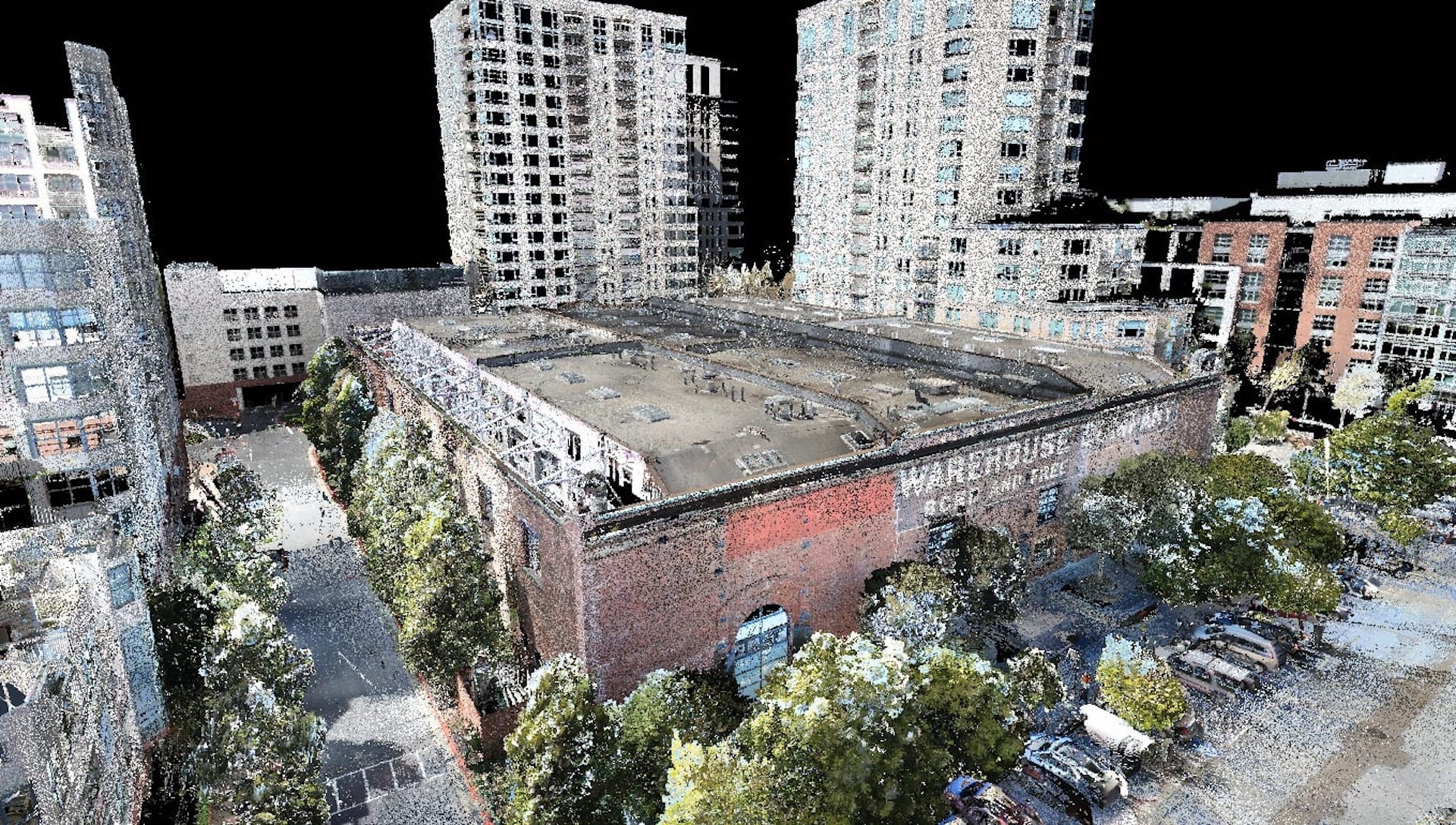
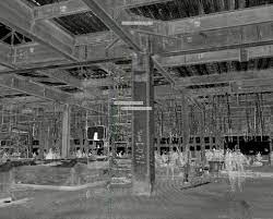
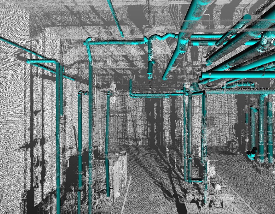
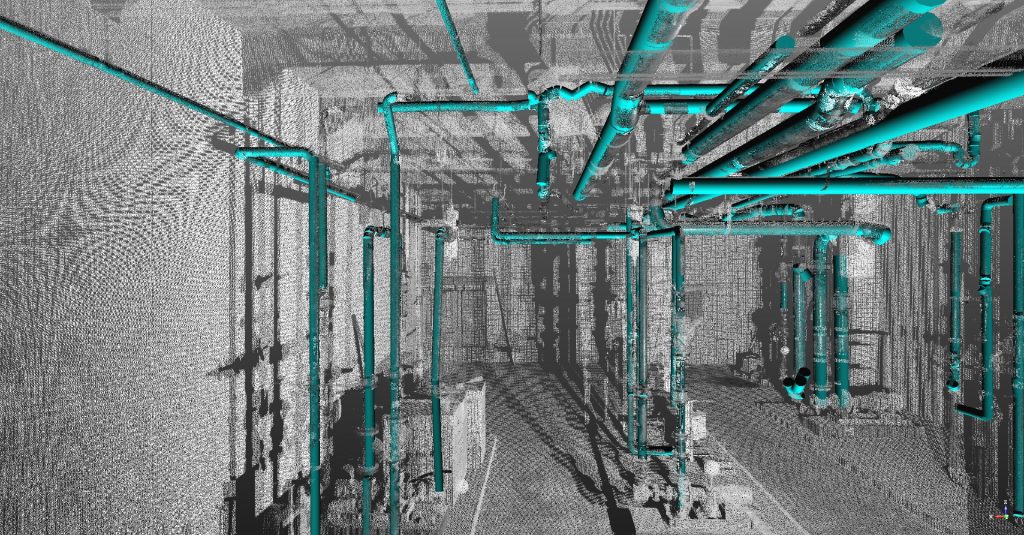
#3: LiDAR
LiDAR, also sometimes called laser scanning, works by shooting pulses of laser light at an object and then measuring the distance based on how long it takes the light to return to the sensor. Like photogrammetry, LiDAR can be used from the ground or the air, but it has become a more accessible and practical scanning technique now that drones are common.
LiDAR is more expensive to operate than photogrammetry, but it provides critical benefits on some types of projects. It is more effective in creating models of sites where trees and other objects block the underlying surface, and can be combined with infrared to create even more accurate surveys. It also creates more points, and as a result the point clouds from LiDAR scanning are more precise.
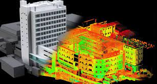
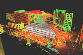
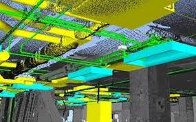
#4: Scan-to-BIM Workflows and CAD Integrations
It’s common today for GCs to own a drone or two and to perform “reality capture” in the form of photos, video, and even infrared images to share with owners and stakeholders and subs. But the true power of reality capture is unleashed when these technologies are integrated into design software and construction workflows.